Risk management and prevention

Status
ongoing
50%
City

Marseilles

Main actors

City Government, NGO / Philanthropy

Project area

Whole City/Administrative Region

Duration

Ongoing since 1995

This project used interdisciplinary cooperation and stakeholder involvement to implement a risk management system.

As a basis for risk prevention policies and intervention the City of Marseilles established a comprehensive risk management system. The initiative established an urban database and GIS mapping system to allow for rapid and continuous identification of risks, assessing and updating information, and indication concerning risk. Natural, technological, urban, and social risks are all covered by the system.

Danger or hazard zones were identified and mapped out to constitute a risk mapping system with the help of stakeholders taking on different roles and responsibilities. At the department or provincial level, major hazard and danger zones were identified by central government. The prefecture compiles relevant information at communal level which is available and accessible to the public. The commune prepares information on preventative measures which are used to formulate local policy implementation options.

The function of this early-warning fully-computerised GIS system enables emergency crews to appraise a situation rapidly, react in an appropriate way, and call upon relevant services to intervene. The system also provides information for risk abatement in post-crisis rehabilitation and reconstruction effort.

This initiative is in general a good example of interdisciplinary and inter-institutional teamwork.

Sustainable Development Goals

Make cities and human settlements inclusive, safe, resilient and sustainablePromote peaceful and inclusive societies for sustainable development, provide access to justice for all and build effective, accountable and inclusive institutions at all levels
City
Marseilles, France
Size and population development
2011: 1,489,000 1990: 1,305,000 2025: 1,786,000 2010-2015 1.30%
Population composition
Over one third of the population of Marseilles can trace their roots back to Italy. Marseilles also has the second-largest Corsican and Armenian populations of France. Other significant communities include Maghrebis, Turks, Comorians, Chinese, and Vietnamese
Main functions
second largest city in France and major trade center
Main industries / business
Port City, fishing
Sources for city budget
Political structure
Mayor and City Council
Administrative structure
Marseilles is divided into 16 municipal arrondissements, which are themselves informally divided into quartiers (111 in total)
Website
http://www.marseille.fr

The principle objective of this project is to establish an urban risk management policy based on the use of information and indicators. Therefore, relevant information and indicators are collected and compiled within a mapping system. With the use of a GIS system, information is made accessible, readable, and usable by the local authorities, decision makers, key partners, and stakeholders.

The city context in which this initiative was launched was characterised by social and economic difficulties as well as relatively low level of awareness on the part of decision makers for ecological and environmental issues. This was caused by lack of coordination and collaboration between various actors as well as a high degree of compartmentalisation across differing sectors and disciplines.

However, for interdisciplinary cooperation such as this, perfect teamwork is necessary. The major challenge at the beginning was to face - and to change - reluctance on the part of many actors to share risk-related information. In the process of using a combination of meetings, diplomacy and commitment, the partners involved also elaborated a common vocabulary for effective dialogue.

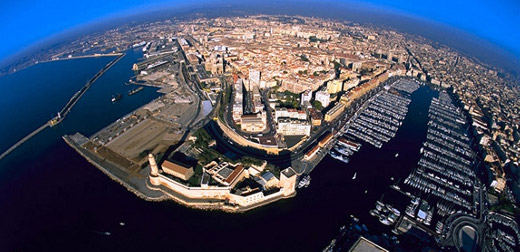
The system is designed to cover comprehensively the whole city of Marseilles.

The initiative began in June 1995. The primary purpose was to develop and maintain a knowledge base for urban risk. This required establishing policy and cross-sectoral inter-disciplinary working relationships. Various levels of government and differing services naturally have their own sources of information, means of assessment, policies, and strategies. From 1995 to 1997, main data was collected and meetings with various stakeholders took place. Initial stages in the initiative involved a series of consultations and raising awareness both with the public at large and with decision makers. Furthermore, priorities were defined on the basis of awareness-raising campaigns and a series of indicators was obtained through studies and surveys from 1995 to 1997. These indicators were for example, sociological indicators such as complaints, vandalism, or absenteeism at school; technological indicators such as severity of fires or floods; natural hazard indicators such as probability and frequency analysis of hazards; economic indicators such as jobs, enterprises or housing stock. Decision makers and elected officials concerned with legal responsibilities associated with risk management focused on intensive raising awareness, and mobilised political support. In summary, the information used to establish the system involves human, technical and financial resources from all relevant services and administrative bodies (see Resources below). Outstanding issues such as collecting and analysing information and indicators pertaining to soil movement and instability, or implementing a ‘local security contract’ between central and local government, to be applied to all risk zones based on comprehensive analysis, needed to be faced.

Involved stakeholders were province administration, civil protection services, such as police and fire services, and central government services, such as ministries of Planning and Environment, Equipment, Industry, Health, Employment, and the Interior. Furthermore, local government services, such as water and sanitation, planning and public works, health, environment, information and communication technologies, public safety, and fire departments took part. External partners including water (Société des Eaux de Marseille), electricity and gas utilities (EDF/GDF) service providers, as well as SCP Société du Canal de Provence, Marseilles Port Authority and French railways SNCF were included. Last but not least, professional service providers, such as university experts and consultants, worked to make the system happen.

In 1997, up-loading data on to a GIS system constituted a milestone in the initiative process. In addition, the City of Marseilles disbursed its first budget allocation.

Expertise and experience derived from the risk management and prevention policy in Marseilles was first shared with cities of the Mediterranean basin in 1998.

Human, technical, and financial resources from all relevant services and administrative bodies were used to establish the information system. Province administration, civil protection services, such as police and fire services, and central government services, such as ministries of Planning and Environment, Equipment, Industry, Health, Employment and the Interior, were also involved in establishing the system. Furthermore, local government services, such as water and sanitation, planning and public works, health, environment, information and communication technologies, public safety and fire departments took part. External partners including water (Société des Eaux de Marseille), electricity and gas utilities (EDF/GDF) service providers, as well as SCP Société du Canal de Provence, Marseilles Port Authority of and French railways SNCF, were included. Finally, professional service providers, such as university experts and consultants, worked to make the system happen.

At local level, IGRC has received new sources of support, in the shape of financial allocation from the City of Marseilles since the first quarter of 1997, as well as improved human and technical resources.

In addition to substantial resources invested by the City of Marseilles, human and technical resources were mobilised from a broad base of actors, involving a lot of goodwill and voluntary work.

Encouraging results revolve around three main developments: basic mapping and GIS system comprise tool development; land legislation and land-use by-laws comprise policy development; and hazard prevention information forms a management system.

Information and indicators which were presented to various stakeholders and decision makers are used for, and integrated with, decision making and policy formulation processes, particularly vis-a-vis norms and strategies. The principal impact, which was also the most visible, has been on land-use planning and land legislation; and environmental planning and management. Changes in utilities management, adopting comprehensive risk prevention, preparedness and intervention strategy, and better communication systems are other areas of impact.

Through adopting a Municipal Emergency Response Plan, which involves all services and streamlining and coordinating response to security and risk prevention and management requirements for the World Cup 1998, better coordination between various actors has also been achieved.

The GIS-RISK system was adopted at an institutional level as an inter-disciplinary and inter-departmental working tool for all administrative bodies.

The system has been the subject of consultation work and exchange of expertise with other cities at national level, for example Cannes, Lyons, Nice and Toulouse. At international level the system also serves as a best practice example: the City of Marseilles is working closely with a network of Mediterranean cities such as Algiers, Barcelona, Casablanca, Genoa, Haïfa, Meknès, Tirana and Tunis.

The greatest barrier or conflict was the major challenge to overcome comprehensive reluctance on the part of many actors to share risk-related information, and forging a common vocabulary for effective dialogue at the beginning of the initiative. This conflict was solved in the process of developing the system by using a combination of meetings, diplomacy and commitment.

According to their own statements, the most important lessons learned by the initiators were establishing human and technical competency and credibility, such as reliable information, analysis and indicators, which essential to overcoming bureaucratic restrictiveness and to introduce change. As a result of the initiative, four variables were applied to their work environment: time or timeliness, inter-disciplinarily, technical know-how / competence, and transparency. Those involved came to the general working conclusion that technical and scientific know-how can be effectively used to formulate public policy by anchoring knowledge in the human factor.

The system of risk management developed in the city of Marseilles, was adapted and / or adopted by several cities, for example, the three French cities of Nice, Cannes and Toulouse.

In June 1998 the initiative was presented at the Mediterranean Summit of Cities. In this way, the Mediterranean Network of Cities was able to benefit from Marseilles’ expertise and experience.

The City of Marseilles has also committed itself to becoming a Local Urban Observatory and to work closely with the Global Urban Observatory to further the aims and objectives of the Habitat agenda.

On Map

The Map will be displayed after accepting cookie policy

Photo gallery

Related case studies

Participatory Development Programme in Urban Areas (PDP)
Cairo, Egypt

Participatory Development Programme in Urban Areas (PDP)

This project advises concepts and methods of participatory community development and grass roots based waste management in informal urban areas.
4°C Cooler – Using green infrastructure to build a climate resilient Melbourne
Melbourne , Australia

4°C Cooler – Using green infrastructure to build a climate resilient Melbourne

In 2010 the city of Melbourne appointed a new Urban Landscape Team to produce a Green Infrastructure Program to cope with a difficult future climate and maintain its economic prosperity and liveability.
Flood Information System of the State of Paraná, Brazil
State of Paraná, Brazil

Flood Information System of the State of Paraná, Brazil

The quality and timeliness of flood warning need to be improved in many places in Brazil. To achieve this aim a complex multi-level and multi-dimensional process is required. The State of Paraná in Brazil has undertaken such a process with promising results.