Size and population development
According to a Ramallah Municipality 2020 study, the city has a population of 71,880 in an area of 18,600 km2 (this represents 1.37.4% of the total Palestinian population). The city is surrounded by 80 communities and refugee camps, and the total number of inhabitants of Ramallah city governorate is approximately 370,000 people). Ramallah is witnessing a very rapid population growth, in 2018 the city's population was 65,696 which results in an annual population growth of 4.1%.
Population composition
Based on population estimates prepared by the Palestinian Central Bureau of Statistics in 2017, there are approximately 13.5 million Palestinians in the world, of whom 5.1 million reside in the State of Palestine. 2.59 million are male and 2.51 million are female. The estimated population of the West Bank was 3.05 million, including 1.55 million males and 1.50 million females. The population of the Gaza Strip for the same year was estimated at 2.05 million, including 1.04 million males and 1.01 million females.
The percentage of individuals in the age group (0-14 years) in the middle of the year 2020 is estimated at 38% of the total population in Palestine, with 36% in the West Bank and 41% in the Gaza Strip. It is noted that the percentage of individuals aged 65 years and over has decreased, as their percentage was estimated in mid-2020 at 3% in Palestine, by 4% in the West Bank and 3% in the Gaza Strip.
The number of Palestinian communities in the West Bank that the Israeli occupation intends to annex reached 43, distributed as follows: 10 communities in the northern West Bank, 30 communities in the middle of the West Bank, and 3 communities in the southern West Bank, where the number of Palestinians was estimated at 112,427 individuals with a total area of about 477.3 km2.
Main functions
Ramallah, a key city in the West Bank, situated 16 Km north from Jerusalem and 64 Km from the Mediterranean seashore, is located at 860 m on the central mountain ranges of Palestine that extends from southern Galilea down to Hebron through Jerusalem. Thus its geographical location, on the road that traverses the central mountain range from Nablus to Jerusalem, has given it a commercial significance since the middle ages. The city is known for its vibrant cultural life and art activities and its very heterogeneous population forming a diverse young cultural cosmopolitan city.
In 1993 Oslo agreements led to the establishment of the Palestinian Authority (PA) in the West Bank and Gaza Strip. Nevertheless Ramallah, as all Palestinian territories still remain under Israeli Occupation where PA control is restrained. As such Ramallah has no control over its natural resources despite its rich water resources.
Following the establishment of the PA, Ramallah became the temporary seat of the Government of the State of Palestine, thus witnessing a rapid growth where only in 7 years the city doubled its built area. The rapid growth formed a challenge for the municipality to upgrade its infrastructure to fit its built landscape.
Main industries / business
The commercial sector:
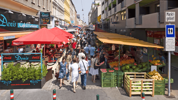
Commerce is one of the biggest economic assets to the city. Being a central location in the West Bank, Ramallah attracts a lot of people from all around the country for retail shopping. The Number of restaurants per capita in Ramallah is one of the highest in the world, and other commercial places don’t fall far behind.
Industry:
Ramallah has a small niche of light industry such as the manufacture of sanitary paper, cardboard, furniture, foodstuffs, olive, soap, aluminium, pharmaceuticals and some handicrafts and traditional goods are common in Ramallah. The industrial zone takes up to 4.2 % of the total city area.
The Tertiary industry plays t a central role in the city’s economy as the majority of service companies in the country lay in Ramallah. For example, one of the telecommunication companies is the biggest employer in the country (after the government). This augments the city’s employment opportunity and demand and rises minimum wage above the national average.
Political structure
The Ramallah and al-Bireh Governorate is one of 16 governorates of Palestine. It covers a large part of the central West Bank, on the northern border of the Jerusalem Governorate. According to PCBS, the Ramallah and al-Bireh governorate has 78 localities, including cities, municipalities, villages, councils, neighbourhoods and refugee camps.
Administrative structure
Ramallah became a city in 1908. Since then, the city has witnessed 25 different municipal councils. Unstable political events led the Municipality to undergo 5 different regimes. In 1967 Ramallah with the rest of the West Bank was occupied by Israeli forces. The city was governed by a direct military force and the Municipal council was s inactive for six years.
Ramallah Municipality is the first point of contact between the community and the Palestinian Government and is responsible for providing essential services and other government functions under the Palestinian Local Authorities Law No. (1) of 1997, including water and electricity supplies, street and town planning, and issuing building permits. The core institutional support structure supporting the Municipality at the central level is the Ministry of Local Government (MoLG) and its Directorates.
Website
http://www.ramallah.ps/
 Smart City, Freedom through Technology project, Ramallah, Palestine - © City of Ramallah
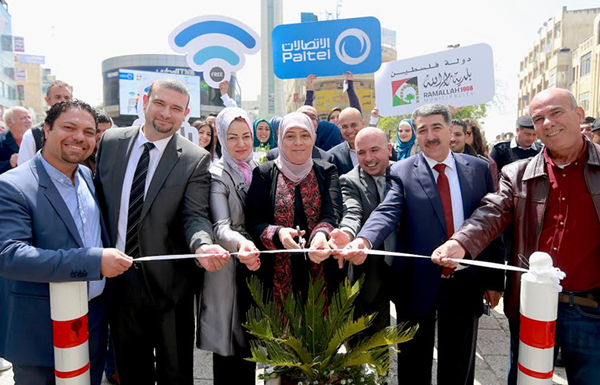 Smart City Freedom through Technology project, Ramallah, Palestine - © City of Ramallah