Status
completed
100%
City
Lima
Main actors
Local Government, City Government, Regional Government, Community / Citizen Group, Public Utility, Supranational / Intergovernmental Institutions, NGO / Philanthropy, Research Institutes / Universities
Project area
Metropolitan Area
Duration
2011 - 2014
Water sensitive urban development
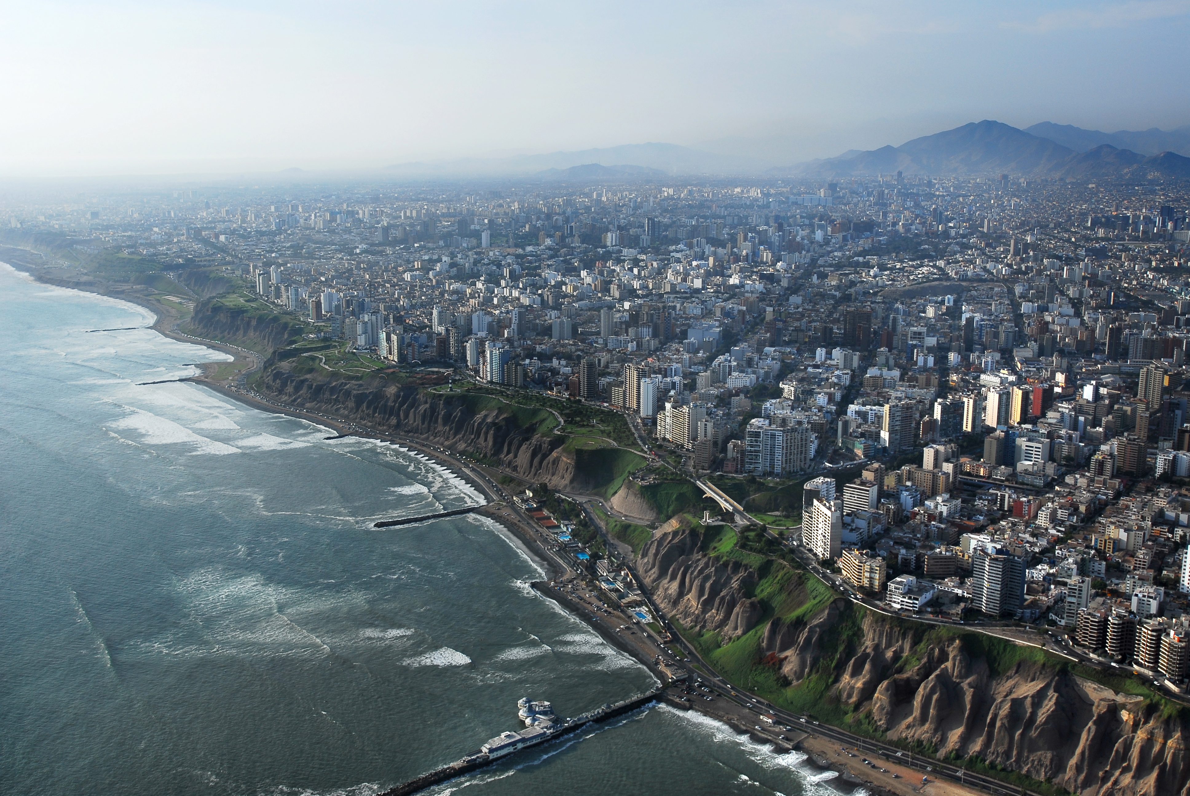
The metropolitan area of Lima (Lima and Callao regions) has a population of approx. 10 million people. The city is located in the desert of the Pacific Coast and is characterised by inequalities in basic services distribution such as provision of drinking water, proper wastewater treatment and access to green open spaces. Lima is one of the Latin American cities with the least green areas per inhabitant (Latin American Green City Index, 2010). Despite efforts to revert this reality, still many public and private green areas are irrigated with scarce potable water, ground water or polluted surface water, while the reuse of treated wastewater is still reduced.
The Lima Ecological Infrastructure Strategy (LEIS) is developed within the Lima Water (LiWa) research project “Sustainable water and wastewater management of urban growth centres coping with climate change”. Its aim is to integrate in a participatory way, urban landscape planning and design with water management, in order to support the urban water cycle. This includes the treatment and reuse of wastewater to increase access to green public spaces and ecosystem service in the city, taking into account different ecological, environmental, socio-economic and cultural landscapes.
Authors: Eisenberg, Bernd, Nemcova, Eva, Poblet, Rossana, Stokman, Antje.
City
Lima, Peru
Size and population development
In 2014, the National Institute for Statistics and Information (Instituto Nacional de Estadistica e Informatica) reported that the population of Lima was 8,852,000 people with a density of 3,008.8 inhabitants per square kilometre (7,793/sq mi). Of the city's population 48.7% are men and 51.3% are women and the annual growth rate was stated as 1.57%. According to INEI, the age distribution in Lima was: 24.3% between 0 and 14, 27.2% between 15 and 29, 22.5% between 30 and 44, 15.4% between 45 and 59, 10.6% above 60.
Population composition
Lima’s population features a complex mix of racial and ethnic groups. Mestizos of mixed European (mostly Spanish and Italians) and Amerindian ancestry are the largest ethnic group. European Peruvians are the second largest group. Many are of Spanish, Italian or German descent and others groups are French, British, and Croatian. The minorities include Amerindians (mostly Aymara and Quechua) and Afro-Peruvians, whose African ancestors were initially brought to the region as slaves. Asians, especially of Chinese and Japanese descent, came mostly in the 19th and early 20th centuries as did jews of European descent and people of the Middle East.
Main functions
Lima is the capital and the largest city of Peru. It is located in the valleys of the Chillón, Rímac and Lurín rivers, in the central coastal part of the country, overlooking the Pacific Ocean. Together with the seaport of Callao, it forms a contiguous urban area known as the Lima Metropolitan Area. Lima is the most populous metropolitan area of Peru and the second-largest city in the Americas behind São Paulo and before Mexico City. Lima is home to one of the oldest higher-learning institutions in the Americas - The National University of San Marcos was founded on May 12, 1551 during the Spanish colonial regime.
Main industries / business
Lima is Peru’s industrial and financial centre and has been identified as one of the world’s fastest growing economies in the 21st century. It accounts for more than two thirds of Peru's industrial production and most of its tertiary sector. The Metropolitan area leads industrial development, largely due to the quantity and quality of the available workforce, transport and other infrastructure. Products include textiles, clothing, food, chemicals, fish, leather and oil derivatives are manufactured and/or processed. Lima has the largest export industry in South America and is a regional hub for the cargo industry. The main export goods are commodities: oil, steel, silver, zinc, cotton, sugar and coffee.
Sources for city budget
National and City goverments taxation revenue.
Political structure
Lima is the capital city of the Republic of Peru and Lima province and hosts three branches of Government: 1) The Executive branch is headquartered in the Government Palace, and all ministries are located in the city. 2) The Legislative branch is headquartered in the Legislative Palace and is home to the Congress of the Republic of Peru. 3) The Judicial branch is headquartered in the Palace of Justice and is home to the Supreme Court of Peru.
Administrative structure
The city is subdivided into 43 districts. The Metropolitan Municipality has authority over the entire city, while each district has its own local government. Unlike the rest of the country, the Metropolitan Municipality, although a provincial municipality, acts as and has functions similar to a regional government, as it does not belong to any of the 25 regions of Peru.
Website
http://www.munlima.gob.pe/
Due to the limited water resources in Metropolitan Lima and inefficiency of the current water system, a new approach to urban planning and water management is needed. This includes new planning and design tools to establish a functional spatial framework to link urban development with the consideration of optimized water use. Building upon the existing scientific and practical knowledge of water sensitive urban design (WSUD) and Green Infrastructure (GI) concepts, adapted to the arid climate conditions, the Lima Ecological Infrastructure Strategy (LEIS) has been developed.
Its aim is to provide integrated planning principles, spatial analysis tools and water sensitive urban design guidelines. This will support the provision of the ecological infrastructure network described as a multifunctional system of open spaces. In turn, this system will help tackle urban development challenges in a more efficient and sustainable way, contributing to improvement and protection of the urban water cycle in a participative way.
The Lima Ecological Infrastructure Strategy (LEIS) consists of (1) Principles to support strategic urban planning and policy making leading to water-sensitive urban development, (2) a Tool to support urban planning to consider the relationship between water and green open spaces, and (3) a Manual with water-sensitive urban design guidelines for project development.
The LEIS-Principles are based on a participatory process as part of the Lima metropolitan urban development strategy. Different workshops with key actors took place with the aim to identify WHAT principles could respond to the different negative processes happening in the metropolitan area related to landscape and urban development, as well as, water and wastewater management. Through that process the LEIS Principles were developed as a set of rules for water sensitive urban development based on a multifunctional open space system that contributes to the urban water cycle. After defining the principles, the identification of WHERE to develop the ecological infrastructure was carried out. Therefore, the LEIS-Tool serves as a GIS-based planning and quantification tool, which supports the establishment of the layout and assessment functions of the ecological infrastructure as described in the LEIS-principles. It estimates water-related impacts of urban growth and quantifies assumptions on water demand and water re-use potentials of design solution test cases. The third main output is the LEIS-Manual, which is a conceptual design tool with a set of water sensitive urban design measures guiding the design process of green areas towards development of water-sensitive green spaces.
The LEIS Principles, Tools and Manual deals with various scales:
- On the metropolitan level, the Principles for ecological infrastructure are defined and harmonized with the Concerted Regional Development Plan, developed by the Metropolitan Planning Institute (IMP), and approved by the Lima Metropolitan Municipality. These principles will be considered in the future Metropolitan Urban Development Plan promoting the implementation of the ecological infrastructure at major scale.
- On the site level, WSUD measures for open space design were developed. Analyses of several existing open spaces and new design projects show how water sources and vegetation are dealt with in the open space design.
To study possibilities for the application of LEIS and discuss the strategy with local stakeholders, academia and residents, the Lower Chillon River watershed was chosen as the LiWa|LEIS demonstration area. In a feedback loop, the findings from the work in the demonstration area, contributed to shape the LEIS water sensitive urban development and design recommendations. The strategy was applied at different scales and working closely with the metropolitan and local district administration, technical agencies, research institutions, civil society and surrounding communities. Results were the Ecological Infrastructure Landscape Framework Plan for the Lower Chillon River valley with a set of acupuncture projects at meso and micro level. Among those, were:
- the design for the “Lower Chillon Ecological River Park Chuquitanta”. This project creates a multifunctional lineal corridor over the river bench that acts as an ecological water treatment facility from various water sources, as flood protection area during rainy season in the upper watershed and as river park for recreation of the more than 500000 inhabitants living and working in the area. Thus, different areas have been defined like urban gardening, recreation, leisure, observatories and interpretation centres connecting the cultural landscapes with the existing cultural heritage. In November 2013 the project “Creation of sport, leisure and cultural services in the Chuquitanta Ecological Park, lower Chillon River Watershed” presented by Park Services of the Metropolitan Lima Municipality (SERPAR) was approved by the Ministry of Economy under the Participatory Budget process (SNIP N° 248792) and is waiting to continue its implementation.
- the “Wastewater Treatment Park – Children’s Park”, located in the San Martin de Porres district, built and inaugurated in 2014 as a recreational area with a vertical constructed wetland treating wastewater from a polluted irrigation channel. The aim of the pilot project was to implement an example applying the LEIS strategy principles, tools and manual for dry areas. The park treats contaminated water for irrigation of green areas, uses less water than a conventional park in Lima, show the benefits of using local native vegetation species and at the same time is an attractive public space for the community.
The Lima Ecological Infrastructure Strategy (LEIS) was developed by the Institute of Landscape Planning and Ecology (ILPÖ) of the University of Stuttgart. The LiWa Project was funded by the German Ministry of Education and Research (BMBF) as part of the Future Megacities Program.
The LiWa coordination was under the Institute for Automation and Communication (Ifak). Key actors were the Stuttgart Research Center for Interdisciplinary Risk and Innovation Studies (ZIRIUS) from the University of Stuttgart; the Institute for Modelling Hydraulic and Environmental Systems, Department of Hydrology and Geohydrology; Ostfalia University of Applied Sciences-Campus Suderburg; the Peruvian water utility company SEDAPAL; Foro Ciudades para la Vida; Universidad Nacional de Ingeniería; FOVIDA - Fomento de la Vida; Helmholtz Centre for Environmental Research (UFZ)-Department of Economics and Dr. Scholz & Dalchow GmbH.
The LEIS project leading and implementing main actor was the Institute of Landscape Planning and Ecology (ILPÖ) from the University of Stuttgart. The partners were the Lima Metropolitan Planning Institute (IMP) and Foro Ciudades para la Vida (FCPV). Academic partners were the Universidad Nacional Agraria La Molina (UNALM), Pontificia Universidad Católica del Perú (PUCP) and the Universidad Nacional de Ingeniería (UNI).
The Wastewaster Treatment Park “Children’s Park” was possible thanks to the request of the community from La Florida II which has shown the power to co-lead the process and support the park design, construction, maintenance, and operation. In addition, the German Ministry of Education and Research (BMBF), the San Martin de Porres Municipality, and the community La Florida II co-financed the project with the aim of benefiting the community by gaining a new green space, to reduction of socio-environmental conflicts in the area.
The overall results (contained in the LEIS Book in the English and Spanish version) include:
- LEIS Principles, a set of rules for water sensitive urban development, considering the integration of water and wastewater into planning and open space design.
- LEIS Tool, a GIS-based planning tool that quantifies demand, availability and potentials for the reuse of water supporting planning and sustainable open space design.
- LEIS Manual, a set of Water Sensitive Urban Design design guidelines for creating green areas towards development of water-sensitive green spaces.
- Conceptual design and design documents (SNIP N° 248792) of the “Lower Chillon Ecological River Park Chuquitanta".
- Construction of the “Wastewater Treatment Park: Children’s Park”, LiWa - LEIS pilot project in the lower basin of the Chillón river, Chuquitanta, Lima.
- Lower Chillon Landscape Framework for the development of an Ecological Infrastructure Landscape considering the ecological, cultural, social, economic and archeological landscape in the area.
- Professional and academic exchange from different programs from Germany, Peru and worldwide. The exchange included international design winter semesters, Summer School and internships.
The main barriers and challenges were connected to:
- Administrative boundaries: Lima and Callao have both the status of Region, Province and District. Therefore, the physical connection of both cities is not relevant at the moment to define policies and implement them because each administration has its own regulations.
- Limited collaboration between Water and Planning technical authorities: The planning authority is led by the Lima Metropolitan Planning Institute which belongs to the Lima Metropolitan Municipality. While the water administration is under the water utility company SEDAPAL part of the Ministry of Housing, Construction and Sanitation. There have been tries for exchange of information and collaboration in different periods but the collaboration is limited.
- Political will: Political interests and disputes interfered with the implementation of key projects.
- Technical capacities: The work under "silos" limit the multidisciplinary approach needed to work on this kind of strategies. There are not many professionals working as landscape planners and landscape architects, as understood in the LEIS approach.
- Technical data and legal documents: Non-updated data and lack of updated planning instruments.
- Interdisciplinary and multidisciplinary approach: Political and technical will to accept the interrelations between water management and open space planning in the urban development of the city.
As in all projects, the specific characteristics of the site and the environmental as well as cultural conditions shape the outcome very much. This is the case with the Lima Ecological Infrastructure Strategy. The transferability of the results and of the tools was always envisaged and the concise presentation of the interlinked outcomes of this part of the project make it easy for decision makers in a similar situation to follow the idea of what to aim for, where to implement it and how to implement it. The way the principles were achieved was specific to Lima though, and in very few other cities with more than 9 million inhabitants a regional concerted development plan could be produced in such a short period of time, in a way that open for ideas from civic society as well as from the research community.
Still the principles that were developed along that process are straightforward and can be adapted to other conditions. The spatial analysis was based on local information and limited due to the accessibility of data. In other cities the situation may be better or worse, but urban planners and water managers need to agree on a unified view on the city in any case, the spatial analyses and the developed tools propose a way how to do it. Finally, the very detailed and site-specific prototype designs based on results from interdisciplinary working groups are a good example of how to illustrate the approach.
Eisenberg, B., Nemcova, E., Poblet, R., Stokman, A. (2014) "Lima Ecological Infrastructure Strategy". Integrated urban planning and design tools for water scarce cities, Institute of Landscape Planning and Ecology, Stuttgart http://issuu.com/ILPOE
Eisenberg, B., Nemcova, E., Poblet, R., Stokman, A. (2014) "Estrategia de Infraestructura Ecológica de Lima". Estrategias integradas de Planificación urbana y herramientas de planificación para ciudades con escasez de agua, Institute of Landscape Planning and Ecology, Stuttgart http://issuu.com/ILPOE
Eisenberg, B., Nemcova, E., Poblet, R., Stokman, A. (2014) In: Space, Planning and Design. Integrated Planning and Design Solutions for Future Megacities. Vol. 5, Jovis Verlag GmbH, Berlin, p. 27-32, p. 79-86, p. 139-163.
ILPOE (2013) Summer school Booklet 2013: Lima Beyond the Park: desert city, culture and water infrastructure. Documentation of student projects: water sensitive urban design options for public schools at both sides of the lower Chillon River Watershed, Lima and Callao, Peru, Faculty of Architecture and Urban Planning, University of Stuttgart.
ILPOE (2013) Seminar Booklet Cities out of water, urban challenges, strategies and Projects dealing with water scarcity, Winter Semester results 2012-2013, ILPOE, Faculty of Architecture and Urban Planning, University of Stuttgart.
ILPOE (2013) International Design Studio Booklet with results of Winter Semester results 2012-2013: Lima beyond the Park: desert city, culture and water infrastructure. Documentation of student projects: urban strategies for Surco Canal, Parque Huascar, Pantanos de Villa, metro and electric lines, Oct 2012 – Feb 2013, ILPOE, Faculty of Architecture and Urban Planning, University of Stuttgart.
ILPOE (2012) Summer school Booklet 2012: Lima Beyond the Park: coupling nature, culture and water infrastructure. Documentation of student projects: water sensitive urban design options for Chuquitanta, San Martin de Porres and Ventanilla, Faculty of Architecture and Urban Planning, University of Stuttgart.
ILPOE (2011) International Design Studio Booklet with results of Winter Semester results 2011-2012: Lima beyond the Park, coupling nature, culture and water infrastructure. Documentation of student projects: urban strategies for lower Chillon River and Lurin River watersheds, Oct 2011 – Feb 2012, Faculty of Architecture and Urban Planning, University of Stuttgart.
Miglio, R., García A., M., Nemcova, E., Poblet, R. (2016) “Water Sensitive Urban Design for Metropolitan Lima – Peru. Wastewater Treatment Park: The Children’s Park - application of vertical flow constructed wetlands in public open space for reuse of treated wastewater”, UNU, United Nations University, Institute for Integrated Management of Material Fluxes and of Resources (UNU-FLORES), Dresden, Germany.
Poblet, R., Nemcova, E., (2014) “Lima beyond the Park”, in ARKINKA, Peruvian magazine for architecture, design and construction, November 2014, Lima, Peru.
Poblet, R., Eisenberg B., Nemcova E., Stokman A., Schütze, M., Leon, C. (2013): Water-sensitive urban planning and design solutions for arid context: The Lima Ecological Infrastructure Strategy. IWW Amsterdam, 4. – 8.11. 2013
Poblet, R., (2013) Water and Wastewater management in the context of climate change: Experiences from Lima, Peru. Evidence and Lessons from Latin America (ELLA), London
Schütze, M. (ed.) (2015): LiWa Transferability Manual - How can LiWa be applied to other regions of the world? Project LiWa – Lima Water; ifak e. V. Magdeburg, with contributions of the project partners.
Stokman, A., Poblet, R., Nemcova, E., (2012) Stadt+Grun, Sommerschule: Wassersensitive Stadtentwicklung in Lima, Germany | Topos 81, Water Landscapes, Lima Beyond the Park, S. 102.109, 2012. Description of the LiWa Project and the Lima beyond the Park concept.
Stokman, A., Poblet, R., Nemcova, E., (2014). "Multidisciplinary Research/Deign/Builds Summer school: Alternative Solutions for Water scarce future in Metropolitan Lima". In “Future Megacities 3: Capacity Development” Jovis Verlag GmbH Vol. 3: 107-121
Video: Summer school 1: https://vimeo.com/230750227
Video: Summer school 2: https://vimeo.com/246124981
Video Pilot Project: https://vimeo.com/230748079
Additional material can also be found on the following webpage:
http://www.ilpoe.uni-stuttgart.de/
Blog: https://www.facebook.com/summerschoolbeyondthepark
Blog: https://www.facebook.com/Beyond-the-Park_Rethinking-Landscapes-452636151455184/
On Map
The Map will be displayed after accepting cookie policy
Want to know more about this project?

Photo gallery