The Madrid Río Project
Status
completedCity
Madrid
Main actors
Local Government, City Government, Community / Citizen Group
Project area
Inner City
Duration
2007 - 2015
The Madrid Río project aims at converting the zone alongside the Manzanares River into green areas to make the city eco friendlier.
In June 2008, the Department of Urban Planning of the Madrid City Council officially launched the Madrid Río Project to reclaim the Manzanares River, restoring the surrounding natural habitat for residents to enjoy. After eight years of planning and construction the last section of Madrid Río was finally opened to the public in April 2015.
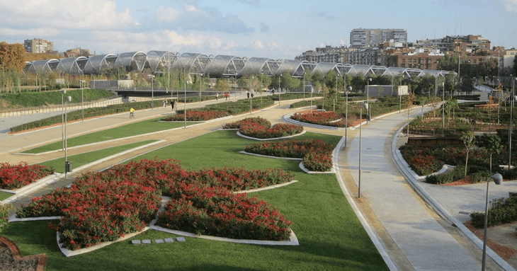
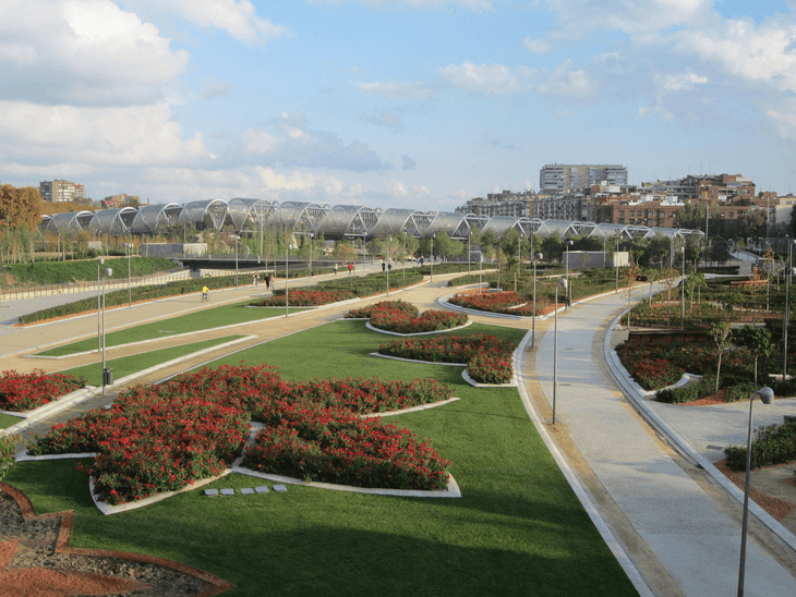
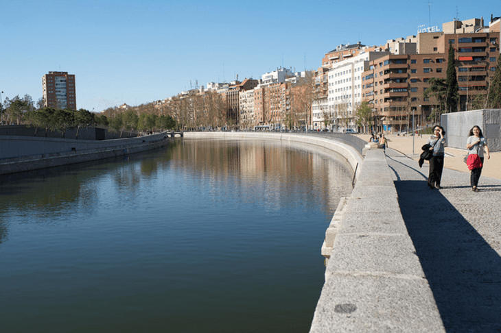
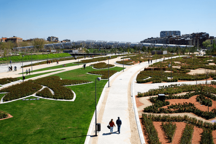
Before launching the project, the city had first to convert the M30 multilane highway underground, resulting in a ten kilometres long parkland area ; 820 hectares have been converted into a long park. The river bank has thus become an integral part of the city centre, and now offers Madrilenians and visitors an area surrounded by vegetation and filled with wide a range of sports, leisure and cultural facilities.
The redeveloped area covers six districts. All this just 1.5 kilometres from the Puerta del Sol in the centre of Madrid.
Sustainable Development Goals
Metropolis Award
This project was awarded the 'Metropolis Award' in 2014 in the following category: Honorable Mention.
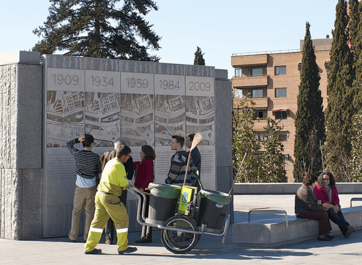
By the 1970’s Madrid became one of Europe’s largest developed cities and a multilane highway was built, encircling the city and destroying the river banks.
In 2004, the city government decided to reverse this situation and developped a plan to reconnect the river to the urban center by taking the multilane motorway underground and reclaiming the natural landscape for green zones and gardens. The Madrid Río Project (new recreational zone along the Manzanares River to relax and enjoy) and the Calle 30 Project (remodelling of the roadway and land) were developed concurrently in order to reclaim more than 2,961 hectares of land in Madrid, creating an ecologic corridor with a total surface area of 129 hectares. The purpose of the Madrid Río Project was to reclaim the river and its surrounding banks as public parks and green spaces for residents.
The objectives included:
- To create new public green spaces along the banks of the Manzanares River;
- To engage Madrid’s citizens in the development of this new public space by encouraging citizen participation and providing information on how the projects could link to other leisure, sports and cultural aspects of the city;
- To improve urban integration between the city center and the districts to the south and west of the city, transforming the Manzanares River from a barrier into a meeting place for citizens, connecting between neighbors and facilities;
- To improve water conditions in the river and insure that pollutants are not emptied into the water;
- To improve mobility, as the city center is much freer from traffic, saving in-city traveling times and reducing accidents.
Both projects were designed with the intention to revitalize degraded and neglected parts of Madrid and to bring back the lost beauty of the city.
This urban transformation plan was configured in two phases:
Phase 1: Calle 30 Project -- The planning and construction of the world’s longest urban tunnel, directing the M30 multilane motorway, which currently forms a ring around the city, underground and installing electrostatic filter ventilation systems to filter the pollution produced by vehicles inside the tunnels.
Phase 2: Madrid Río Project -- The redesign and implementation of a new linear park along the banks of Manzanares River that reconnects both sides of the city and allows pedestrian access to the river. The Madrid Río Project creates an environmental axis from Monte de El Pardo to Getafe and reclaims area for new green space, parks, playgrounds and recreational spaces. It also integrates a new urban park with existing parks and creates an ecologic corridor totaling 2,961 hectares. Madrid Rio Project involved 142 single plans, classified under five categories:
- Continuity measures: Plans to facilitate accessibility such as the Salon de Pinos (pine tree park) or the Portugal Avenue renovations;
- Open spaces: Plans to reforest and create a new canopy of trees by designating protected areas;
- River: Plans to make the Manzanares River more accessible by gangplanks, bridges, piers and pontoons;
- Urban Services: Plans to make equipment and public activities possible such as sports, educational programming, and cultural events and provide sanitary services. Also to refurbish existing facilities;
- Roads: Plans to improve the road network, post new signage, provide more pedestrian accessibility via sidewalks, construct bicycle paths and offer parking.
Madrid Río Project involved the following construction plans:
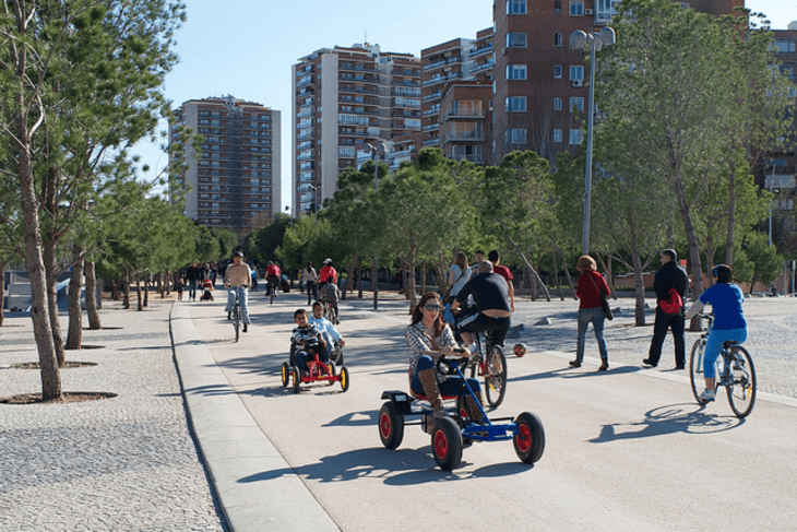
- Creation of 54 kilometers (33.5 miles) of pedestrian walks and 30 kilometers (18.6 miles) of new cycling routes;
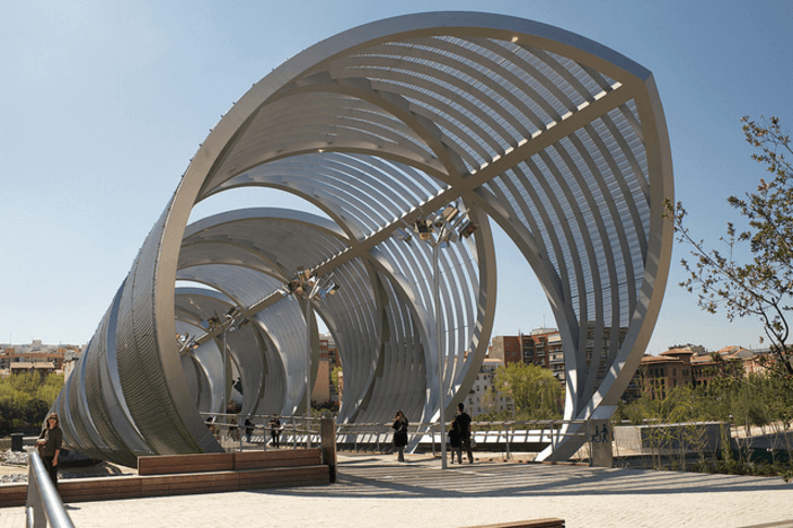
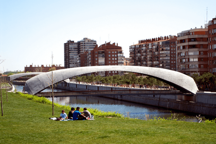
- Creation of 35 bridges, dams and catwalks with the renovation of 6 bridges and rehabilitation of 13 old dams and catwalks; - Construction of 12 new overpasses for pedestrians and cyclists;
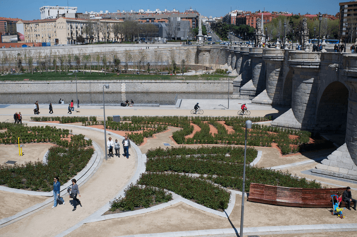
- Restoration of historical stone bridges, such as Puente de Segovia, Puente del Rey and Puente de Toledo;
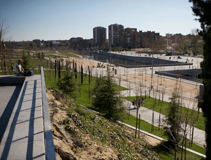
- A 6 kilometer long and 25 meter wide green walk in the western bank form the Pine Park;
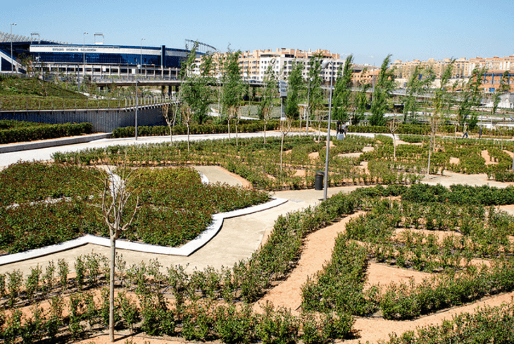
- Restoration of the urban green area with more than 33,550 trees to join the gardens of Campo del Moro (near the Royal Palace) and the Casa de Campo Park, and 460,054 units of new shrubs;
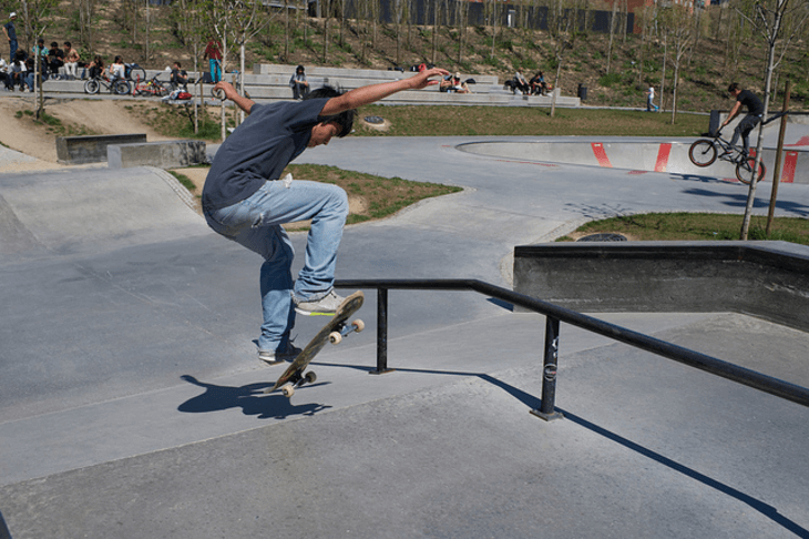
- Construction of 17 new children playing zones, 3 spaces for elders, and 253,601 square meters designed for sports use, including 43 courts and a new dock for paddle sailing;
- The creation of new cultural venues;
- Enlarging several river banks to act as a dam;
- Improvement of water quality in the Manzanares River with 13 new kilometers (8 miles) of pipes, 27 storm tanks and improvements of sewer plants surrounding the river. This allowed the creation of a beach near Matadero, 11,280 meter (37 feet) of renovated water network and 5 tanks of reclaimed and recycled water with a daily capacity for 5,200 m3.
The Madrid Río Project involved a significant number of changes to the city’s streets, especially for those which terminate at the river, giving them continuity and promoting new areas for walking. New street furniture has been installed, giving 250,000 square meters of new cultural, health and social programming space along with nine parking lots for residents with 4,303 parking places.
The cost of the Madrid Río operation is officially estimated at 4.100 million euros, of which a 10% would correspond to ground surface operation and a 90% to the reform and burying of the infrastructure in the Madrid Río area.
The total cost of the Madrid Calle 30 project (the reform of the M-30 highway) has raised from an initial budget of 1.700 million euros to an estimated final cost of 6.000 million, with payment in 30 years.
For the construction, maintenance and financial operation a new company was created, Madrid Calle 30, with an 80% public and 20% private participation. The investment in maintenance for the next 35 years is 3.200 million euros.
In the construction of the last phase of Madrid Río, an important role was played by the anti crisis fund deployed by the state for public works, which financed 235 million euros.
The final cost of the Arganzuela bridge, one of the new foot bridges, designed by the architect Dominique Perrault was 13.6 million euros.
Madrid Río has been incorporated into the city, becoming a new icon that adds specific features and values to the city’s attractions, with the full integration of Madrid’s only river in the day-to-day life of its inhabitants.
In total, a universal-access surface area of 1,210,881 m2 was treated, structured around nine areas of reference. Throughout the length and breadth of Madrid Río, there are now 30 kilometres of cycle paths; 33 sports fields for skating, skateboarding, climbing, 7-a-side and 11-a-side football, futsal, padel tennis, tennis, basketball and BMX cycling; 17 children’s play areas with 65 elements; 3 fitness trails with 22 elements; 7 pétanque courts; 12 games tables; 3 cultural event platforms in the Puente del Rey and Matadero and an Interpretation Centre for the Manazares River, which adds to the Matadero Madrid cultural centre.
In addition, with the aim of making the park more comfortable and enhancing its enjoyment, 5,506 new benches, 63 drinking fountains, 84 bicycle racks with 637 spaces, as well as 8,528 lampposts have been installed.
To facilitate crossing between the districts located on both banks of the river, there are 33 walkways, noteworthy among which are newly built bridges that have become new city icons given their uniqueness. Water is one of the main features in the park, which is home to 13 ornamental fountains, and a city beach comprising three aquatic areas located in the Arganzuela park, thereby meeting the request put forward by children in the Madrid Río Children and Young People’s Competition.
Moreover, this new green lung constitutes a superb point from which to contemplate the city from its five viewing points: Glorieta de San Vicente, Huerta de la Partida, Segovia bridge, Arganzuela bridge, and the Nudo Sur pedestrian and cycling walkway.
The City of Madrid faced numerous traffic congestion issues during the construction of Calle 30. Drivers faced temporary detours that changed almost daily, and caused problems for drivers, especially at night. A traffic simulation analysis conducted with a VISUM software transportation planning package was a key tool in making project design decisions.
As with all large projects, the Madrid Río Project was not without controversy. The Tagus River Commission, responsible for public water, imposed a series of environmental conditions for the execution of the project. Also, the municipal opposition asked the EU to demand the city council to conduct an environmental impact assessment and seek a visit by an EU parliamentary committee to observe and assess the project. The result of this visit was positive, as the EU committee acknowledged that the projects were being carried out in accordance with EU regulations, adding credibility to the project by addressing all concerns from the government and residents.
The world is becoming increasingly environmentally conscious. Any city considering a project such as the Calle 30 or the Madrid Río Project should focus on substantive environmental benefits. Countries and cities seeking solutions for reclaiming degraded areas can look to the Calle 30 and Madrid Río Projects for guidance on how to publicly explain environmental benefits from such projects.
The success of the project depends on a number of factors such as the current economic situation of the city. Outside parties have shown great interest in the management and financing model of the Calle 30 Project, specifically in the integration of European Union legislation and the project approval and contracting process.
The Madrid City Council has played a central and decisive role in the two projects. The city of Madrid learned that a flexible financing scheme is critical in coping with complexity and the budget requirements for this type of project.
Due to the dimensions and complexity of the project, the Calle 30 Project has become a model for other cities and organizations. In the last two years, the City Council has received hundreds of visitors from mayors and political figures worldwide. Countries which are currently planning to make improvements to their current transportation infrastructure, such as Poland, Russia, the Czech Republic, Romania, Hungary, France and Italy , have visited the Calle 30 Project and have shown major interest in the project. The Calle 30 Project has also received visitors from South America and Asia. Due to this exchange, many companies involved in the Calle 30 Project have recently been selected for infrastructure contracts in the U.K. and the U.S., and some are very active in Eastern Europe.
The M30 project was on display in the Urban Best Practices Area of the 2010 World Expo Madrid Pavilion in Shanghai. Visitors could learn about Madrid’s urban renovation and view a visual display of the project. The theme of the Expo was “A Better City for a Better life” and therefore Madrid’s M30 project was selected as a transferable best practice for display. Thanks to the Expo many visitors, particularly from China, learned about how to implement a similar project.
- New York City Global Partners, Best Practice: Large-Scale Green Space Reclamation Plan, February 2012: http://www.nyc.gov/html/ia/gprb/downloads/pdf/Madrid_MadridRioProject.pdf
- Franchini T. Arana, J. The Mega-Blue-Green Network: Madrid River Project 47th ISOCARP Congress 2011: http://www.isocarp.net/Data/case_studies/1872.pdf
- Metropolis World Congress 2014 in Hyderabad, 2nd Special Mention Madrid “Madrid Río”: http://www.nyc.gov/html/ia/gprb/downloads/pdf/Madrid_MadridRioProject.pdf
- Madrid - Wikipedia: https://en.wikipedia.org/wiki/Madrid
External links / documents
Want to know more about this project?
Contact our community manager.

Photo gallery


Do you like this project?
Related case studies
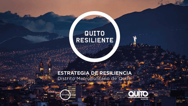
Quito, Ecuador
Metropolitan District of Quito Resilience Strategy
The city of Quito is preparing to face the challenges of the 21st century based on its adaptive capacity, which is built on social and economic inclusion, efficient urban performance and environmental sustainability.
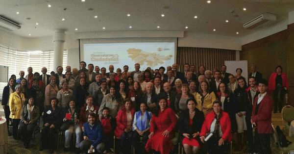
Bogotá, Colombia
Citizens’ Observatories in Bogota, Colombia
Citizens’ Observatories are collaborative spaces where citizens voluntarily participate in a public request and accountability process, based on the implementation of the “District and Local Administration Follow-up Tool”.
Berlin, Germany
Oderberger Street: participative renewal of a h...
The main challenge of this project was to implement a concept of street renewal respecting the historically grown character of Oderberger Street and conserve the unique identification the residents have, while still satisfying needs of a modern urban environment.