m4guide - mobile multi-modal mobility guide
Status
completedCity
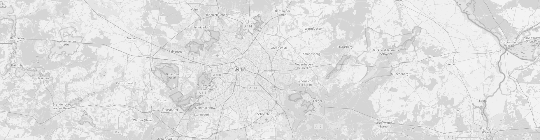
Berlin
Main actors
City Government, Community / Citizen Group, Public Utility, Research Institutes / Universities
Project area
Neighborhood or district
Duration
2012 - 2016
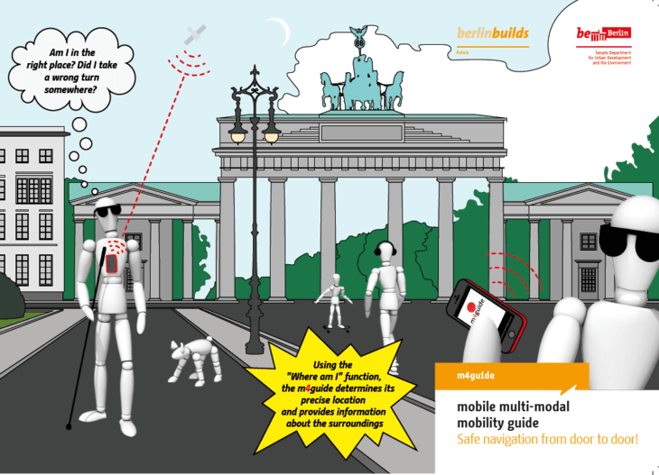
m4guide stands for an integrated communication and navigation system by which the user is led continuously from door to door. As a result, the m4guide increases the user's opportunities for mobility in the city.
The m4guide app for Android was developed as part of the m4guide research project (mobile multi-modal mobility guide). m4guide is a continuous travel information and traffic guidance system for Berlin-Mitte, the central district of Berlin, enabling seamless navigation in public street space, including the use of the local public transport network and route guidance in buildings. In strengthening the possibilities of individuals to participate in all spheres of social life, the project contributes to implementing the UN Convention on the Rights of Persons with Disabilities ratified by Germany in 2009.
As a navigation system that meets extensive requirements for the blind and partially sighted people, m4guide is also transferable to other groups of individuals. In order to ensure continued use of the project's outcomes in Berlin, the innovative navigation system will be integrated into the existing Fahrinfo ("trip info") navigation system of the Verkehrsverbund Berlin-Brandenburg (VBB) and the Berliner Verkehrsbetrieben (BVG). The Berlin Senate Department for Urban Development and the Environment is supporting its successful integration in both those systems.
Sustainable Development Goals
Approximately 145,000 blind people and 1.2 million partially sighted people live in Germany. In order to get from place to place, they are often reliant on the local public transport system. A continuous navigation system that includes all forms of transportation, with which the blind and visually impaired can get from door to door in an unfamiliar urban environment by foot, with public transport and at stations and citizens’ information offices, has not been successfully implemented thus far.
In 2010, led by heureka Consult with the project partners IVU Traffic Technologies AG, Verkehrsverbund Berlin-Brandenburg and Fraunhofer FIRST, the feasibility study GALILEO-basiertes verkehrsmittelübergreifendes Ortungs- und Navigationssystem für blinde und stark sehbehinderte Personen in Berlin (3MGuide) ("GALILEO-based comprehensive transportation tracking and navigation system for blind and highly visually impaired people in Berlin - 3MGuide") was implemented by the Berlin Senate Department for Urban Development and the Environment. The m4guide project followed this investigation of outdoor and indoor tracking and route guidance as well as the research project Guide4Blind conducted by the administrative district Soest, in which a blind-friendly guidance system for local public transport was developed.
The objective is to develop a consistent transportation navigation system aimed at the blind and visually impaired people that includes all forms of transportation. This system will help them traveling from place to place in an unfamiliar urban environment, whether they are on foot, using public transport, at train/bus stations or in citizens’ offices. m4guide can however be used by anyone who is attempting to orientate themselves in an unfamiliar urban context.
With its particular focus on pedestrian navigation for the blind and visually impaired, the m4guide project was enthusiastically supported by the Deutscher Blinden- und Sehbehindertenverband ("German Association for the Blind and Partially Sighted") and the Fichtenberg Oberschule Berlin ("Fichtenberg Secondary School, Berlin"). As such, in cooperation with the target group, requirements catalogues and user profiles were created and function tests conducted.
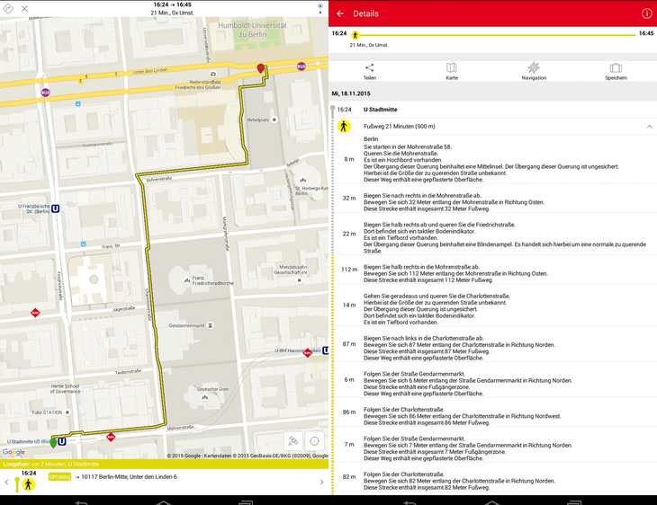
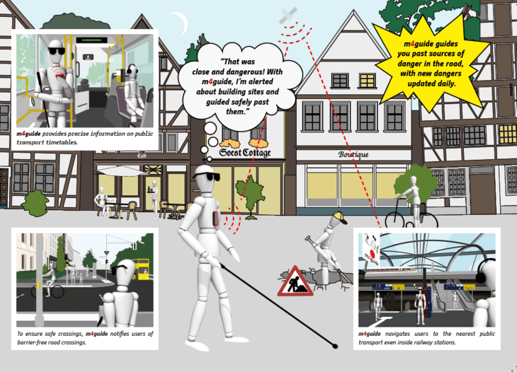
The project comprehensively uses the possibilities offered by digitalisation: pioneering work was performed by the Berlin technology provider eagle eye technologies GmbH and a procedure using a stereoscopic acquisition system to investigate all the street segments was developed. 3D information was derived from this investigation data and all street objects and spaces were recorded with maximum accuracy. This data – together with the real-time data on restrictions in the Berlin streetscape provided by the Berlin administration – forms the data basis for the project. Furthermore, the location-specific incident data taken from street segments serve to expand the information system for the blind on footpath works and street closures. Additional real-time timetable data is available for navigation in the local public transport network. These are based on existing travel information systems for local public transport. A complex total architecture of servers and services connects the components with one another.
In the absence of satellite navigation systems in indoor spaces, a tracking solution was developed by Fraunhofer FOKUS (Frauenhofer Institute for Open Communication Systems), including Wifi field density, inertial sensors as well as Bluetooth and optical technologies. Furthermore, the navigation in urban areas with strong shading was supported by the underlying data model of footpaths in order to enable the blind and visually impaired pedestrians to better orientate themselves.
Additional uses of the data include areas such as autonomous driving and high-capacity transports, which both have high requirements for street data and street geometrics. This data basis is not solely intended for use with the m4guide, but is also intended as a municipal data stock provided free to the public. In the future, this data can be re-used for mobility studies in the area of accessibility. The Senate Department for Urban Development and Environment is also striving to ensure that civil engineering departments receive this data to later apply it in planning and implementing streetscape construction work.
As part of the Von Tür zu Tür – eine Mobilitätsinitiative für den Öffentlichen Personenverkehr der Zukunft ("From door to door – a mobility initiative for the local public transport network of the future”) research initiative, the Federal Ministry for Economic Affairs placed 4 million euros at the disposal of the m4guide project. The companies involved contributed an additional 1.6 million euros.
If the concepts, procedures and components developed in the m4guide are implemented in the VBB traffic info app and scaled correspondingly, the mobility of all citizens will be enhanced: the navigation from the front door all the way to the contact’s office at the district office using public transport breaks down barriers against participation in social activities and provides security in everyday life.
As part of the project, new data models and acquisition rules for a multitude of street objects and traffic areas were developed, which have thus far not been recorded in this way and to this extent in Germany. The newly introduced street data for the project will be published freely under Open Data. The high quality and data density will enable start-ups and other technology firms to develop new and innovative geo-technologies for the region. As a result, the accessibility of the city and its local public transport network will be strengthened considerably, since extensive journey information can be retrieved at any time.
An acquisition catalogue still needed to be created for various street objects and their significance for pedestrian traffic, which had not been recorded thus far. Furthermore, pedestrian tracking is still problematic in inner-city areas and in buildings with current Smartphone technology. For this reason, innovative solution concepts were developed as part of the project.
Between outdoor navigation, public transport route guidance and indoor route guidance, a complex overall architecture of servers and services needed to be implemented into the existing offer.
With the preparation of street data from the m4guide project and investigations in other districts, the state of Berlin is providing for the first time a free broadly based data basis across the public streetscape. Building on that, private citizens or start-ups can generate economic added value.
The objective of developping a consistent transportation navigation system that includes all forms of transportation is not an isolated solution; it is the preparation of integration into the traffic information systems of the Verkehrsverbund Berlin-Brandenburg (VBB) and the Berliner Verkehrsbetrieben (BVG). Consequently, mobility is strengthened for blind and visually impaired people, as well as all others who require orientation for daily journeys across the whole of Berlin and the surrounding area in Brandenburg.
The m4guide will first be implemented in the cities of Soest and Berlin. An extension to other areas is also planned for the long-term.
- Berlin Senate Department for City Development and the Environment
Want to know more about this project?

Photo gallery


Do you like this project?
Related case studies
Antwerp, Belgium
EcoHouse Antwerp - Fighting poverty and unemplo...
Antwerp is running an advice and demonstration centre for residents to improve energy efficiency of homes.

Greater Helsinki, Finland
Helsinki Region Infoshare (HRI)
In 2010, the cities of the Helsinki Metropolitan Area began sharing public data for anyone to use freely. These open datasets, available through a web platform (www.hri.fi), make it possible for citizens to develop applications and follow public decision making.
Zaragoza, Spain
La Colaboradora: a P2P co-working space promoti...
A co-working space where a community of some 200 entrepreneurs, freelancers and creative professionals each dedicate four hours of their time every month in return for support with launching their projects. The principle is an exchange of services, ideas and knowledge through a ‘bank time’ approach.